
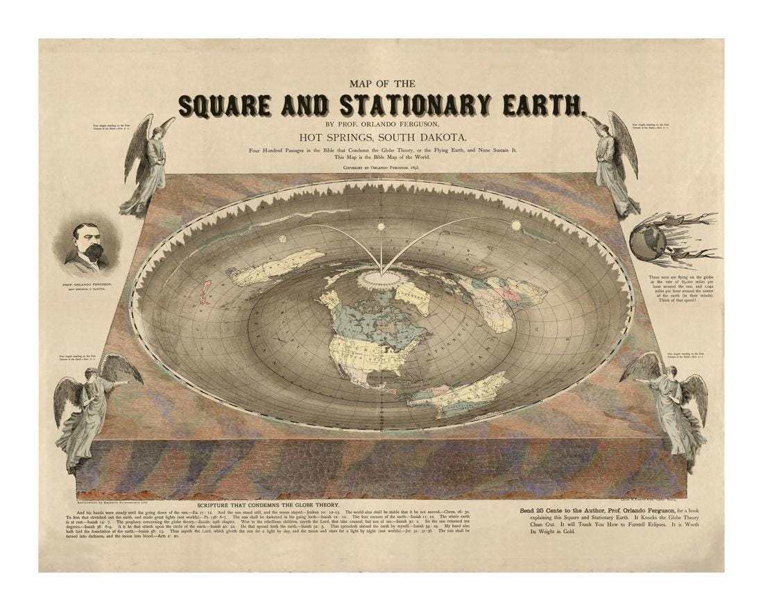
The map known as the “Square and Stationary Earth” was created in 1893 by Orlando Ferguson, an American surveyor based in South Dakota. At the time, the scientific consensus on the shape of the Earth had already been well established for centuries. The spherical model of the Earth had been accepted since antiquity and was reinforced by developments in astronomy, navigation, and geodesy through the work of figures such as Isaac Newton and others.
Ferguson’s map does not follow that model. Instead, it presents the Earth as a flat, rectangular plane with four corners, surrounded by a boundary and covered by a dome-like firmament. The design reflects a literal interpretation of certain biblical passages, particularly references to the “four corners of the Earth,” which Ferguson took as a physical description rather than a metaphor.
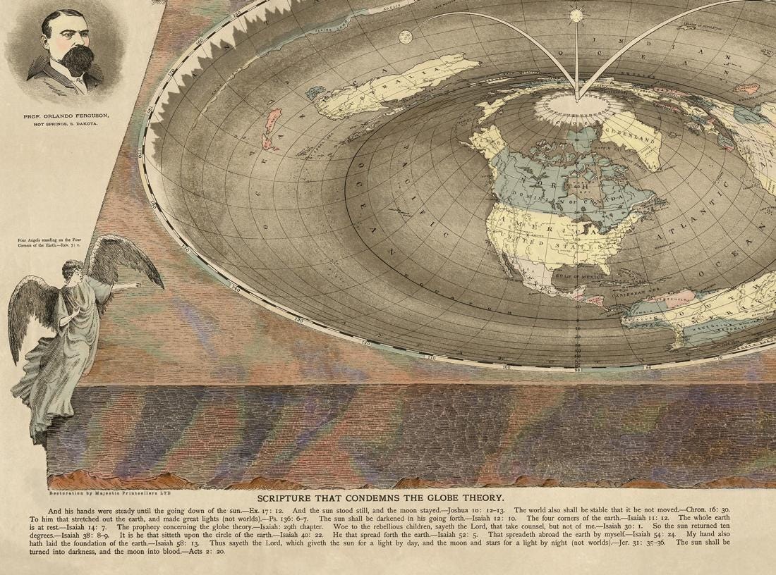
The map includes a series of diagrams and written explanations intended to support this view. Among them are arguments against the curvature of the Earth, references to the apparent motion of the sun and moon, and claims about how gravity and perspective would function on a flat surface. Ferguson’s goal was not to create a decorative image, but to present what he believed to be a scientifically and scripturally consistent model of the world.
The timing of this work is significant. By 1893, the field of astronomy had advanced considerably. The heliocentric model of the solar system was long established, and measurements of the Earth’s size and shape had been refined through centuries of observation and calculation. Global navigation, long-distance communication, and increasingly precise mapping all relied on the understanding of the Earth as a sphere.
Ferguson’s map therefore stands in contrast to the prevailing scientific knowledge of its time. Rather than representing mainstream thought, it reflects a minority viewpoint that sought to reconcile observable phenomena with a specific interpretation of religious texts.
The visual layout of the map reinforces this approach. The rectangular Earth is framed by surrounding elements that depict the heavens and the movement of celestial bodies. Text is integrated throughout the image, providing explanations and arguments directly on the map itself. This combination of diagram and commentary was intended to guide the viewer through Ferguson’s reasoning step by step.
Despite its divergence from accepted science, the map is a documented historical artifact. It provides insight into how alternative cosmological models were presented and defended in the late 19th century. It also reflects a broader pattern in the history of science, where competing ideas—some supported by evidence, others by belief—coexisted and were debated in public and printed form.
Today, Ferguson’s “Square and Stationary Earth” map is preserved in collections such as the Library of Congress, where it is cataloged as an example of 19th-century cartographic and cosmological thought. Its continued circulation as a print highlights its historical significance rather than its scientific accuracy.
As an object, the map records a specific moment in time when established scientific understanding and alternative interpretations were both being expressed through visual media. It shows how diagrams and maps were used not only to represent accepted knowledge, but also to challenge it.